Showing posts with label Olympic National Park. Show all posts

Thursday, August 18, 2011

Hoh River Trail and Mercury in Fish


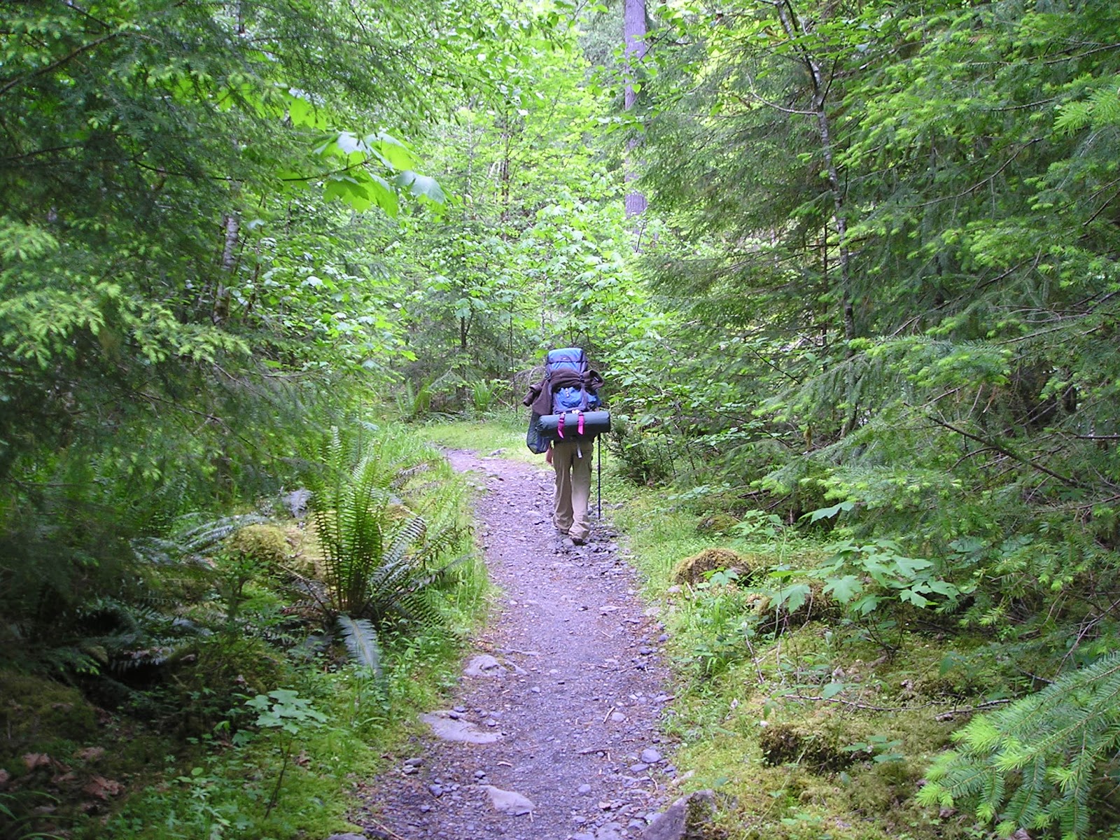
   I went backpacking up the Hoh River Trail earlier this week. We made it 14.8 miles up to Martin Creek -- quite a bit further than I had been previously. The weather was beautiful and, other than deciding to hike all the way out on the third day rather than stay one more night as originally planned (not the best decision), it was a near-perfect trip.

   There were an unusual number of people on the trail. While the Hoh River Trail is one of the more traveled trails in the park, this week there were even more hikers than usual. We stopped and spoke with one of the rangers at the Olympic Ranger Station along the trail and he commented on the high level of traffic. It's no surprise, the weather was still cold and wet right up until August. The ranger said that he didn't recommend climbers try to make the climb up Mt. Olympus (the end of the Hoh River Trail) this year as the snow still obscured the route. Even those familiar with the area were having difficulty staying to the "path".


   Another interesting thing I discovered at the Olympus Ranger Station was a sign posted with fishing information. At the bottom of the sign was a warning that fish from the Hoh River have been found to contain high levels of mercury. It got me thinking, how do fish in a river sourced solely from snow and ice in a National Park of over 900,000 acres become contaminated to the degree of needing a warning posted?

   I understand that pollution in the air travels into the park and that fish have the ability to swim beyond the borders of the park and then back upstream. But the park takes up much of the Olympic Peninsula and is surrounded by a very small population (probably the largest town around the park would be Port Angeles, with a population of around 19,000), an ocean, and the Puget Sound. It seems like it should be safely isolated. Granted, it is surrounded by National Forest areas where much industrial logging takes place, but the water is flowing out from the park, not into it.

   So I got online when I got home. From Wikipedia:

"Much of the mercury that eventually finds its way into fish originates with coal-burning power plants and chlorine production plants. The largest source of mercury contamination in the United States is coal-fueled power plant emissions. Chlorine chemical plants use mercury to extract chlorine from salt, which in many parts of the world is discharged as mercury compounds in waste water, though this process has been replaced for the most part by the more economically viable membrane cell process, which does not use mercury. Coal contains mercury as a natural contaminant. When it is fired for electricity generation, the mercury is released as smoke into the atmosphere. Most of this mercury pollution can be eliminated if pollution-control devices are installed."

   Here's my point, the Olympic National Park is one of the largest National Parks (the eighth largest, not counting Alaska's Parks) and it is situated in a relatively isolated corner of the U.S. It should be one of the cleanest places on earth and still, it isn't safe to eat the fish.

   What the hell are we doing?


Friday, July 22, 2011

Trip Report: Mt. Rainier, July 17-19, 2011


   I had been hoping to do a backpacking trip in the Olympics this weekend, but the weather just would not cooperate. After consulting the maps and trail guides we decided our best two options were Dosewallips on the east side or Obstruction Point a little further north. Then we learned the road to Dosewallips was washed out and Obstruction Point was under six feet of snow and not accessible by about three and a half miles. After a little more looking to find another option in the Olympics we turned to our recent excursion to Mt. Rainier and decided on the option of camping up at Longmire and doing day hikes from there. Disappointing in that we have recently outfitted ourselves better for backpacking, but under the circumstances we were happy to wait for better weather.


   Of course, the day before we planned to leave two unforeseen events conspired against us. The first was a minor disaster that meant spending most of the day with the landlord, a plumber, and a repair company. That's a whole other post, but the end result is that I got no packing or prep done at all. The second thing was the weather forecast dramatically changed from a 10% chance of rain to 40%-60% over the three days. We have enough experience with this area to know that means we have 100% chance of getting wet. My wife is a pretty good sport, but camping, hiking, AND being wet is a combination that would likely equal her final outing of the season and maybe even a hard sell next season. We bit the bullet and decided to book a room. The National Park Inn at Longmire was full, so we found a cabin just outside the park entrance. Now the backpacking trip had turned into a cabin vacation with hiking excursions…

   On Sunday we arrived at the Gateway Inn around 3pm. After getting checked in to cabin #1, sorting out our gear, and a meal from Gateway's restaurant, we entered the park and drove up to Longmire. We decided we had just enough daylight to make the Rampart Ridge Loop. It was a more difficult uphill climb than we anticipated, gaining about 1300 feet in just over a mile. By the time we arrived at the viewpoint overlooking the Longmire complex we questioned whether we should press on or turn back. We had already spent about half the daylight we had and were only about a third of the way. Since the hard part was behind us, we decided to press on.

   The trail was beautiful. After another mile or so we came upon the junction with the Wonderland Trail. I pulled out my camera to take a picture and started hearing mosquitoes. Just before coming to the Wonderland Trail, the path made it's way around a swampy pond, obviously the breeding ground for these little bloodsuckers. I got one photo before my wife exclaimed that the mosquitoes were covering me. They smelled blood and swarmed. By the time we were able to get away from the mosquitoes I had eight bites on my neck and face. My wife got a couple bites on her face and hands. Our son was untouched. Unfortunately, the rest of the hike was an itchy race against the impending darkness and our near-full bladders.   As we neared Longmire I noticed a trail marker in the other direction indicating a trail to Paradise, 5.7 miles. Hmmm... We ultimately returned to Longmire, utilized the restrooms, and made the drive back to our cabin.

   By the time we got to the cabin, showered, and dressed, it was almost 9:30pm and the Gateway's restaurant was closed. We decided to drive toward Ashford and see what was available. After driving about 6 miles we came on a country store that was open until 11pm. We picked up a couple things and headed back to the cabin for the night.

   Monday morning the sun came in through the windows and rousted my wife and I early. We let our son sleep while we looked over maps, discussed the day's options, packed up, and snacked on granola and trail mix. We decided to head up to Paradise and check out some trails there, starting with Dead Horse Creek. Upon arriving at Paradise, we set out on Dead Horse Creek Trail, which was buried under eight feet of snow. The mountain was currently at 600% normal snow cover. We didn't even make it to the Nisqually Vista before deciding we were ill-equipped for the conditions and turned back. Feeling a bit discouraged, we went to the Paradise Inn just as the dining room was opening for lunch, so we got a table and reconsidered our plan for the day.

   While having lunch one of the servers, Doug from Wyoming, stopped by our table and suggested we head over to the Ohanapecosh area and check out the Grove of the Patriachs and the Silver Falls Trails. Excellent! We had a new plan. After lunch we got in the car and headed east down the mountain.

   The parking lot was full at the trailheads, so we parked in the overflow area just beyond the lot. Here is one major difference between the Olympic National Park and Mt. Rainier National Park: Mt. Rainier gets a lot more tourist traffic. I have become used to going out for a Sunday-Tuesday excursion and seeing few, if any, people after the first day in the Olympics. Here it was Monday and it was crowded with people from all over the world!

   I voted for taking the Silver Falls Trail first and no one vetoed. The trail is a gradual decent to Silver Falls, only about 0.3 miles from the trailhead. We watched the falls for a while and snapped some pictures before continuing on the loop. The loop goes about a mile and a half along the east side of the Ohanapecosh River to Ohanapecosh Campground and then back up the west side of the river. I was not aware the the campground is a full-on, eight-loop, car-camping and RV set up until we arrived, but the restrooms were a welcome surprise.

   Unfortunately, my wife's new hiking boots were beginning to hurt her feet, having not yet been broken in. We took a short break before slowly making our way back up the other half of the loop. By the time we arrived at the trailhead my wife was not up for hiking the Grove of the Patriarchs. I guess we'll have to do that one next time.

   We took our time driving back through the Ohanapecosh, Paradise, and Longmire areas, pulling over frequently to take photos.

   Back at the cabin, we showered and got online to consider our options for dinner. After reading reviews for our options within a reasonable distance, we opted for the Copper Creek Inn & Restaurant. When we arrived the place was packed and we were told there would be a short wait. Totally understandable -- it appeared we hit the dinner rush. We browsed the gift shop which featured all kinds of blackberry foodstuffs and our table was ready in surprisingly short order. The place is pretty small, but still they seemed understaffed for the amount of business they had. At one point the crowd seemed to thin and we thought the rush must be over, but only minutes later the place was packed again. It was also very hot inside. If I had it to do over I would ask to sit outside. Still, dinner was good, as was the overall experience.

   We returned to the cabin and I made a suggestion for the following day: how about my wife and son drop me off at Longmire and I make the hike up to Paradise while they explore the tourist attractions. I would meet them at Paradise and we could have lunch before heading home. My wife's feet were sore from her new shoes and my son was thrilled with the idea.

   Tuesday my wife was up before me and was half packed before I was even awake. We loaded up the car, checked out of our cabin, and made our way to Longmire. At the trailhead I put on my pack loaded with the ten essentials and started up the trail. I estimated two and a half to three hours, give or take, to meet my wife and son at Paradise.

   My first setback was only a tenth of a mile up the trail when I second-guessed myself and thought I had possibly chosen the wrong trail. I went back to the ranger station at Longmire and verified that I had the correct trail, I merely needed to walk a little further to the junction for Narada Falls and Paradise. That cost me some time.

   The path up to Cougar Rock runs between the road and the Nisqually River. Since it's only about a mile and a half from Longmire to Cougar Rock, there were many hikers from one or the other along the way. At Cougar Rock the trail takes an immediate right across the Nisqually River, but I missed the turn and inadvertently explored the Cougar Rock area some before returning to the trail and realizing my mistake. This was my second setback.

   From here the trail leaves the road and takes a more direct route to Narada Falls following the Paradise River. I began to gain some elevation. Again, since the section of the trail from Cougar Rock to Narada Falls is only a few miles and includes Carter Falls along the way, I came across many hikers along the way. One thing that I noticed is that very few hikers I came across were what I would consider to be adequately equipped for wilderness hiking. Granted, a hiker here is rarely, if ever, more than a mile or so from a trailhead, road, campground, etc. and there seems to be no end of other people to rely on if something were to go wrong. Still, in my mind, it's an unusually wet and cold summer, it's the wilderness, and stuff can go wrong. I was amazed at the number of people I saw walking around in cotton shorts, cotton t-shirts, cotton socks, a pair of shoes, and nothing else.

   Let me take a minute to review the ten essentials for any hike, no matter how short you intend it to be:

  • Map
  • Compass 
  • Sun protection
  • Extra food & water
  • Extra layers
  • Headlamp/flashlight
  • First aid kit
  • Whistle and/or signaling device
  • Fire starter
  • Knife


   These lists can very from source to source (the original list coming from The Mountaineers in the '30's), but the idea is to be prepared in the event one gets lost or injured. Chances are good that no one hiking between Longmire and Cougar Rock is going to wind up having to spend a night in the wilderness. Even if one were to break a leg and be unable to walk, chances are pretty good someone would be along soon to get help and the road is right there. Still, wouldn't it be nice to have a whistle to blow to try and get someone's attention or something to put on when it starts to rain? Speaking of rain, cotton kills. If you're out hiking and it rains or you fall in the water, cotton will hold onto that water and drop your body temperature. There are many natural and synthetic fibers that are much better suited for outdoor activities.

   Just sayin'.

   Back to my hike…

   By the time I arrived at Narada Falls I had about 40 minutes before my three-hour estimate to arrive at Paradise was up. The trail from Narada Falls is only 1.2 miles, but I knew it would be steep and I knew there would be snow and I would probably be late. What I didn't know was that the entire trail from Narada Falls to Paradise was buried under several feet of snow. Fortunately I had my map and compass and was able to stay headed the right direction even if I was unsure about where the trail was supposed to be. After about a half a mile the trail comes to the road where it crosses the Paradise River and then continues north to Paradise for 0.7 miles. I came out on the road only 100 feet or so from where the trail actually was. From there it was just a matter of following the compass and any foot prints and pole holes I could spot. It was a steep incline and the snow did not make things easier.

   I finally spotted the roof of the Paradise in about three and a half hours after my family had dropped me off -- a half hour longer than I estimated. Considering the setbacks, I felt pretty good about it. A red fox sitting along the trail just off the road watched as I left the trail and crossed the parking lot to meet my family.

   After finding my wife and son in the lobby of the Paradise Inn, I dropped off my pack in the car, we had lunch while we shared our experiences of the previous few hours, I changed my clothes, and we headed for home. On the way out we saw several hoary marmots near the side of the road.


   I made note of three major differences between Mt. Rainier and the Olympic Mountains on this trip. The first one I talked about: there are a lot more people at Mt. Rainier. Also, the trails where we were seem to be a lot less isolated. In the Olympics you can literally walk for days without coming up on anything more than a rustic ranger outpost or a small, primitive camping area with a pit toilet, maybe bear wire. On Mt. Rainier (at least in the areas we saw), unless you head toward the summit it seems rare to go a mile or two without coming across some car-accessible attraction. That's not necessarily a bad thing, but I tend to prefer a more secluded experience. Last, the terrain at Mt. Rainier seems to be more extreme. The Olympic National Park has more than it's share of steep hikes and scenic vistas, but it also has many trails that are more mild with relatively little elevation change. My family has enjoyed backpacking and hiking these less extreme areas. We were hard pressed to find trails that weren't strenuous for my wife and son on Mt. Rainier.

   For myself, I still want to hike the 93-mile Wonderland Trail that circles the mountain. Maybe next year...

Tuesday, June 28, 2011

Trip Report: Backpacking The North Fork of the Skokomish River. June 19-21, 2011


   Sunday, June 19th. The forecast called for a 30% chance of rain until 4pm, so we didn't hurry as we got some coffee, loaded our packs into the car, and stopped for food on our way to the Olympic National Park. Our driving destination was Staricase, an area on the southeast corner of the park. The first year we moved to Washington we did most of our camping at Staircase and Big Creek nearby in the National Forest. (My hike up Mt. Ellinor started from Big Creek.) From there we would don our packs and hike four miles up the North Fork of the Skokomish River Trail to Spike Camp.

   The weather was a bit overcast with highs in the low 60's. This was our first backpacking trip of the year and we were all out of shape after a long winter. My son was not thrilled about the four-mile hike with a pack on his back. I wish we could have worked up to it and done a few warm-up hikes, but the weather has been awful and we've been so busy. The first day is always the hardest.

   At our first stop to take a break and drink some water we realized that my wife's water bottle was gone. Somewhere it had fallen out of the pouch on her pack. Only a minor setback as we carry an extra water bottle to have at camp for cooking, cleaning, etc. We stopped at the next creek crossing to fill up the spare bottle and top off the other two.

   When we arrived at Spike Camp we still had plenty of daylight, so we took our time setting up. Before I had the tent up our son had rebounded from his misery and was bouncing off the trees. We set up the tent, sleeping bags, filtered water, built a fire, had some food and drink, and were almost ready to call it a day before the sun went down. I was able to start the fire without a match using tinder from the area, a small bit of tissue, some magnesium, and a flint.

   I had traded my hiking boots for my new Vibram Five-Finger barefoot shoes as soon as we arrived and they were a welcome change. In fact, the only downside to the barefoot shoes I noted on this trip is that they are not warm on a chilly night. The Tevas aren't warm, either, but it possible to put on a pair of wool socks with the Tevas. Not so much with the barefoot shoes. Still, I think the barefoot shoes will continue to be a part of my warm weather backpacking gear.

    Monday, June 20th. That night, for whatever reason, we all woke up during the night and had a difficult time getting back to sleep. As a result, it was 10am before we got up the next day. After some coffee and a bit of food, we took down camp, packed up, and headed up the trail just before noon. It was mostly cloudy with a high in the low 60's. We filtered some water on our way out since the nearest water source is a little way up the trail. Our plan for today was flexible -- we would hike up to the next camp which is Big Log and at that point decide if we wanted to stay there or continue on to Camp Pleasant.

   This section is where we started to run into some minor obstacles. The trail winds along the side of a reasonably steep hill and there were places where a tree had fallen across the trail and had to be scrambled over. At one point I spotted what we believe to be a ptarmigan appear on the trail ahead and then duck back into the brush. As we approached we were able to spot her again with maybe a half dozen baby chicks following her.

   We got to the spur for Big Log and the sign said Camp Pleasant was only 1.4 miles further. We agreed to press on.

   There were three major creek/river crossings along the way: Madeline Creek, Donahue Creek, and the Skokomish River itself. The Donahue crossing was no problem as there was a log bridge over the water. There was a good-sized, well-built bridge high over the Skokomish River. The Madeline crossing, however, was a different story. There were still signs up indicating a river ford, but it was clear that flooding had seriously altered the terrain at some point. The current river crossing is a large log with a single rail on the downstream side about 20 feet over a pretty respectable water flow. My wife isn't a fan of high ledges. I, on the other hand, will jump off a bridge tied to a bungee cord. I found the crossing a little nerve-wracking; I can only image how my wife felt. It was the highlight of the trip for our son, of course.

   After we crossed the Skokomish River the trail followed pretty close alongside the river. There were a couple minor challenges like loose footing down and back up into post-flooded creek beds and scrambling under small fallen trees. A short distance before Camp Pleasant we rounded a corner to find a fallen tree over the trail -- not a small tree, but one that had been around during the founding of Rome. Seriously, it was probably seven feet in diameter where it covered the trail. It took a little exploration but we found where a handful of previous hikers had made a way over. After helping each other over we were happy to find Camp Pleasant just beyond the huge obstacle.

   Like Spike Camp the night before, we had the place to ourselves. We picked the spot next to the river, took off our packs, and set up camp. My wife took our son down to the river to play. I tried to start the fire using only tinder, magnesium, and the flint and got some smoke, but had to resort back to the tissue for flame. We ate some food, played games, and sat talking around the campfire. At one point my wife stopped, spotting a deer over my shoulder. The buck continued to come closer and we tried to be still and quiet so as not to scare it away. It wandered into the neighboring camp site, grazing along the way and did not seem very concerned with us. We were able to get pretty close and get some pictures before it decided to head up the hill.

   We enjoyed the campfire well after the sun set and then retired to our sleeping bags. We had not seen another person all day. With the sound of the river just outside, we all slept soundly through the night.

   Tuesday, June 21st. The next morning the sky was clear and blue. Our son was up before my wife and I. We had seven miles to hike out plus the drive home today. We didn't hurry, but after breakfast we divvied up the tasks of cleaning up, taking down camp, and getting packed so we could get going. The weather was beautiful and I was happy to have my sun hat. Since this trip was an out-and-back, it was nice to know what to expect. Once we were over the huge tree near Camp Pleasant, we knew the hardest part was over.
   As we approached the dreaded crossing of Madeline Creek, my son spotted a deer on the trail ahead. This deer was being followed by a fawn that still had it's spots. The two darted up the hill and into the trees. Just beyond was the bridge and on the other side was another hiker with his eyes on the hill behind us. "Did you see the deer?", he said, holding up his hands to indicate the size of the little one.

   We took a break on the other side of Madeline Creek and then continued on. We took another break at Spike Camp. We were making better time than expected. Some point beyond Spike Camp four hikers appeared ahead of us. The hikers turned out to be fly fishers who were just looking for a better spot to wet their hooks. They continued to disappear and reappear ahead of us as our pace varied. A wild rabbit came out onto the trail and ran away from the fishermen -- right at us! The little guy got surprisingly close before it finally noticed us and ducked back into the brush. We also spotted some other critter that I thought at first to be a chipmunk darting back and forth across the trail, oblivious to the fishermen and us. It turned out to not be a chipmunk and we're still not sure what it was, but there was a bird nearby squawking loudly at the critter. We suspect the bird may have been protecting it's eggs and the critter was looking for a meal.

   The last two miles were difficult. Again, I wished we had been able to work up to this trip. We never did spot our lost water bottle and there was no one at the ranger station to ask if it had been turned in. After stowing our packs in the car, we drove down to the campground restrooms for a quick clean-up and then headed for home.

   Over the course of the trip I kept notes of things we forgot or needed to acquire/change/upgrade. Being our first trip of the year, the list was disturbingly long and the subsequent trip to REI expensive. On our way back from the Olympic National Park I added one last thing to the list: don't forget a change of clothes to leave in the car for the drive home.

Wednesday, June 22, 2011

Home

   We got home last night from our backpacking trip up the North Fork of the Skokomish River in the Olympic National Park. I'm working on a trip report, but I also have much to do, clean up, put away (and the lawn needs to be mowed)...

   So until I get the report up, here are a few pictures:


Saturday, June 18, 2011

Prepping For The First Backpacking Trip of 2011

   I'm taking a break from stuffing stuff sacks, rinsing water filters, consolidating food into minimal packaging, and sorting out who ends up carrying what. I am reminded that our camping french press that served us well for several years cracked last season and has not yet been replaced. I'm also disappointed to learn that I cannot locate my headlamp. I know I used it in recent months for getting firewood for the woodstove, but it is not where I thought I left it and has not turned up in the 37 other places I thought it might be. Frustrating.

   The weather today is wet and grey, but I've been watching the forecast closely and the next few days promise decent weather. The plan is to head out to Staircase in the Olympic National Park and hike up the North Fork of the Skokomish Trail. After consideration it was agreed that excursions around Mt. Rainier would wait until later in the summer.

   I am looking forward to bringing my new Vibram Fiver-Finger shoes for camp shoes, river fords, and such. I love my Teva's which have taken this role in the past, but the Five-Fingers are so much lighter and will certainly give me better traction in the water. I also have a new sun/hiking hat I picked up at the big annual REI sale. This will be my son's first camping trip with his headlamp that he got for his birthday (I wish I knew where mine was...).

   I have the SPOT set up to let our family know we're okay while we're away. There's still a lot to do. I should get to it...

Wednesday, May 11, 2011

Weekend Update

   Tonight brings to an end a three-night weekend, something of an event of late. The weather wasn't as great as forecast, but this afternoon was beautiful. Our backpacking tent which was washed a couple weeks ago finally got the seams sealed and treated with Nikwax Solarproof. After last week's trip to Mt. Rainier we are talking about a camping trip with day hikes around the Longmire/Paradise area. Since the weather is looking like that won't be in the cards this month I am hoping to put together a backpacking excursion to Upper Lena Lake in the Olympic National Park before we hit Mt. Rainier.

   While waiting for the weather to improve we did some laundry, dishes, picked up the wife's serger from the shop, and backed-up the wife's desktop.We are now ready to start consolidating some hardware, moving some furniture, and making room to create a new sewing/craft space in the living room.

   The pepper and tomato sprouts are doing great inside. Unfortunately, the weather is not cooperating to move them outside yet. We picked up peat pots and some organic soil for the bigger plants, but have yet to transplant them. 

   I was able to erect the tee-pee trellis for the peas that are starting to come up in the garden, sweep the driveway, do some edging, seed the bare spots in the lawn, fill in some of the larger chicken divots in the lawn, and do a little rough mowing (I'm saving the real mowing for when the grass gets too tall for the chickens).

   Speaking of chickens, the neighbor's dog was inside this afternoon, so we were able to let the girls free-range for a while today. I tipped up some pallets where the firewood was stacked and it was all-you-can eat-buffet.

   For dinner tonight the wife made dough while I picked a couple cups of fresh oregano that is still going strong from last year's garden and we had homemade pizza.

   Yum!